Jonny Pascoe put the trip together as part of his two-month ‘retirement expedition’ to the North Island. Numbers had grown to a lucky thirteen and we gathered at Jamie Anderson’s farm near Fielding. Seven Canadian canoes were loaded onto the trailer behind the mini-bus to take us to the start- an empty stretch of riverbank on a small tributary of the Whanganui River. We sorted and stowed our gear and share of expedition equipment- tents, sleeping bags, mattresses, cooking pots and food and drink for fourteen people for five days. Jamie was a master of his art, his equipment included a camp oven from which he miraculously produced roast meat, fresh scones and muffins, and an enormous thermoset made from a domestic copper hot water cylinder, capable of boiling 35 litres of water in no time at all. Gourmet bush cuisine no less- we did not go hungry. The canoes were open Canadians, 17 feet long with one seat in the bow, a central stowage section and another seat in the stern for the steersman who was effectively the skipper. Betty and I began the trip with Betty in the bow and me in the stern and quickly settled into a routine that worked well enough. Between the two of us, our gear, the tent, 25 litres of fresh water and a large crate of kitchenware, we carried a considerable payload. Even so, the canoe remained quite manoeuvrable and was responsive even at critical moments.
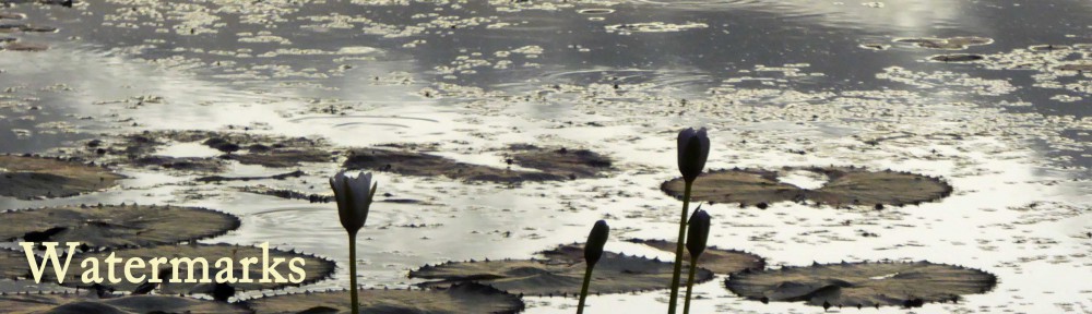
All the gear was loaded into the canoes and lashed to the thwarts- a precaution that was to prove wise on a number of occasions in the coming days. Most of us were entitled to a Senior’s Card but we all relished the outdoors and were looking forward to the challenge. It was late afternoon and the first night’s camp was only a couple of tentative hours away. Between the starting place and the get-out point at Pipiriki, 59 miles downstream, there are no roads, no habitation, no cell phone coverage- only the river. And what a river- set between high banks covered with native bush in a hundred shades of green and littered with debris from earlier storms; dead tree trunks- grey, twisted and gnarled into works of art. A spiritual river to the Maori people and their forebears and you can understand why. We certainly saw it at its best, with sunshine all the way. In lashing rain and a headwind it would have been a very different place.
Camp on the first night was at Mangapapa on a grassy plateau above a shingle bank on a bend in the river. Each camp was a basic Department of Conservation (DOC) site. A simple bench with a sloping roof shelter above to catch the rain to provide fresh water and a long drop toilet hidden in the bush completed the amenities. It was enough- we pitched camp. The following day was the longest day’s paddle- 20 miles and quite hard work. A glorious summer with minimal rainfall meant the river was the lowest it had been for many years. It still had a number of rapids though, and the low water level meant that we bumped our way across some of the shallows and many of the rocks and tree stumps normally well submerged, lurked just below the surface. It was one such that caused the first tip out. Tom and Peter were part way through a fairly significant rapid when they hit a vertical tree stump smack on the bow. The canoe went sideways and rolled, tipping the crew into the water. Betty and I hit the same stump but amidships, we rocked violently, taking on a lot of water in the process. Later in the day it was the turn of David and Heather who, by their own admission, did not fully communicate the presence of a highly visible rock in mid-stream. They hit it fair and square and the force of water jammed their canoe sideways onto it. It took four people to get it off and bail it out, fortunately it was undamaged. The second and third night’s camp was a welcoming clearing in the bush, though getting there involved a steep climb up a narrow path and steps from a beach of soft sand. The sun was high in the sky and after the second or third carry, laden with equipment, some of us collapsed semi-comatose on the grass! Day three was a rest day from the boats- instead we climbed a steep track through some glorious bush to a 1300ft peak in the heat of the morning. It was quite a scramble in places but we were rewarded with fine views including Mount Ruapehu the active volcano to the east. Return to camp was celebrated with a river bath to wash away the sweat of the hill, some of us swimming as nature intended. Taking the kit back down to the canoes at the start of day four was much easier than carrying it up. A few miles downstream we tied up at a steep slippery bank and set off for the bridge to nowhere. It lies a mile or two inland up the Mangapurua valley along a good footpath that was once a four foot road. After the 1st World War, the land in the valley was parcelled up and given to returned servicemen to transform it into farmland. Families moved in and began a twenty year struggle to tame the wild valley. The scheme failed and the last families left in the early years of the Second World War. The only thing remaining of substance is an arched concrete bridge sitting high above the valley stream. It has become known as the bridge to nowhere although it is a vital link in a long distance walking track. We paddled another hour or more to another stop on the opposite bank. A shorter walk took us to a dramatic waterfall where convenient bathing ledges carried the water over the final drop of perhaps ninety feet. A nearby plaque records that John Gordon Dicker was killed here on the 26th September 1941.
Back on the river we continued to our last night’s camp at Tieke Kainga. The site is alongside a Maori meeting house- a marae. It is beautifully carved and immaculately painted but whether visitors are welcome or not depends on the member of the Maori iwi in residence. Sadly, on this occasion, we were not invited to visit. This stretch of the river is busier with jet boats and kayaks taking travellers upstream to the bridge to nowhere and the camp was the only one that we shared with others. On the morning of the last day Jamie held a briefing on the pebbly beach. We would be tackling the two biggest rapids so far and were given clear instructions on how to approach them. Yet at the first one there was some inevitable confusion amongst the crews- ‘Is this the first big one?’ ‘Should we be on the right of the stoppers?’ ‘How far to the right- a metre, half a metre?’
We had been joined by Maori brother and sister Rowan and Gwen paddling the river on their own. Gwen was steering from the stern and several times she stood up to try to pick up the best line as we approached. They were just in front of us and her apparent anxiety was in danger of becoming contagious. We watched Jamie and Helen go safely through in the leading canoe but then Tom and Peter in a following boat tipped out again. One or two more went through then it was Gwen and Rowan’s turn. We could see a lot of white water ahead and the canoes were fair galloping along as each one descended the rapid. Gwen’s anxiety was not misplaced as they too turned over and finished the descent clinging to the side of the upturned boat. Then it was us. I wasn’t able to keep us completely clear of the rough stuff and we got swamped but managed to stay upright- more or less. We landed on the bank and spent a considerable amount of time bailing! Everybody cleared the second big rapid safely and after a few more smaller ones we were unexpectedly at the finish at Pipiriki. Elation at finishing safely was mixed with some disappointment that the journey was over. And what a magical journey it had been, five days paddling our self-contained canoes, camping, exploring, swimming and bonding with good companions. It is etched in the memory and we will look it up from time to time I’m sure.
Some photos and a Video of the trip